The importance of healthy soil and carbon sequestration to mitigate climate changes
Blog > Article > The importance of healthy soil and carbon sequestration to mitigate climate changes
Soil, often underestimated, serves as the cornerstone of numerous vital processes, including carbon sequestration, crop management, and ecosystem protection.
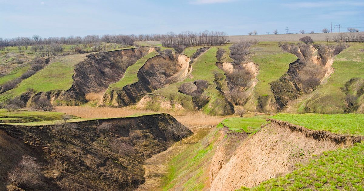
Yet, this vital resource faces escalating threats of degradation, stemming from erosion, contamination, and the depletion of organic matter. As populations surge and climate change intensifies, the strain on soils only grows. Soil erosion, a pervasive threat to soil health, manifests as the detachment and removal of soil particles by the erosive forces of the nature (or humans). This gradual process unfolds in distinct stages, beginning with the dislodgment of soil particles, followed by the transport of these particles across the landscape.
- Water erosion, triggered by rainfall exceeding the soil's infiltration capacity, often leads to soil surface runoff. Such erosion manifests in creating gullies, rills, that eventually cause the loss of fertile topsoil.
- Wind erosion, though less prevalent, is equally destructive, particularly in arid regions where dry, loose soils are susceptible to being swept away by gusts. Wind has the strength to lift and transport soil particles across vast distances, leading to land degradation and desertification
- Air pollution can also vastly influence the health of soil, especially as we are at the same time also polluting the precipitation that waters the soil and powers the hydrosphere. Heavy metals like nitrogen oxides or sulphur dioxide can be dangerous in too saturated forms, affecting firstly the soil and later also plants’ roots which might lead to biodiversity losses.
- Human-made erosion is also on the top of the destructive factors’ list with tillage erosion, stemming from agricultural practices like plowing.
The consequences of soil erosion extend far beyond the physical loss of soil - it diminishes agricultural productivity, compromises water quality, and disrupts delicate ecosystems as well.
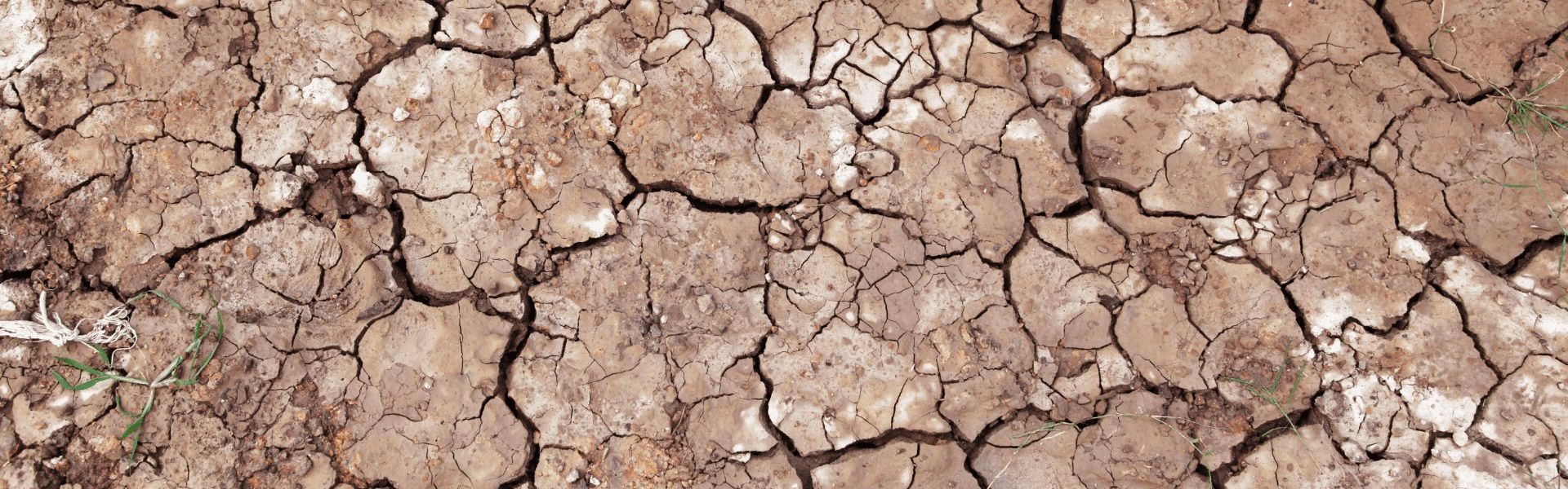
 A real life example of eroded soil
What does ‘healthy soil’ mean?
Soil is indispensable for sustaining life on Earth, serving as a foundational element in ecosystems and agriculture. At its essence, soil health embodies the capacity for soil to sustain life - its ability to nurture life, fostering an environment rich in vital microorganisms and essential nutrients. Healthy soil, enriched with organic matter and minerals, provides the necessary support for plant growth, water retention, and carbon sequestration so important for achieving carbon neutrality.
Assessing soil health involves evaluating its capacity through its physical, chemical, and biological properties. Key indicators of soil health include its structure, nutrient content, microbial activity, and ability to support plant growth.
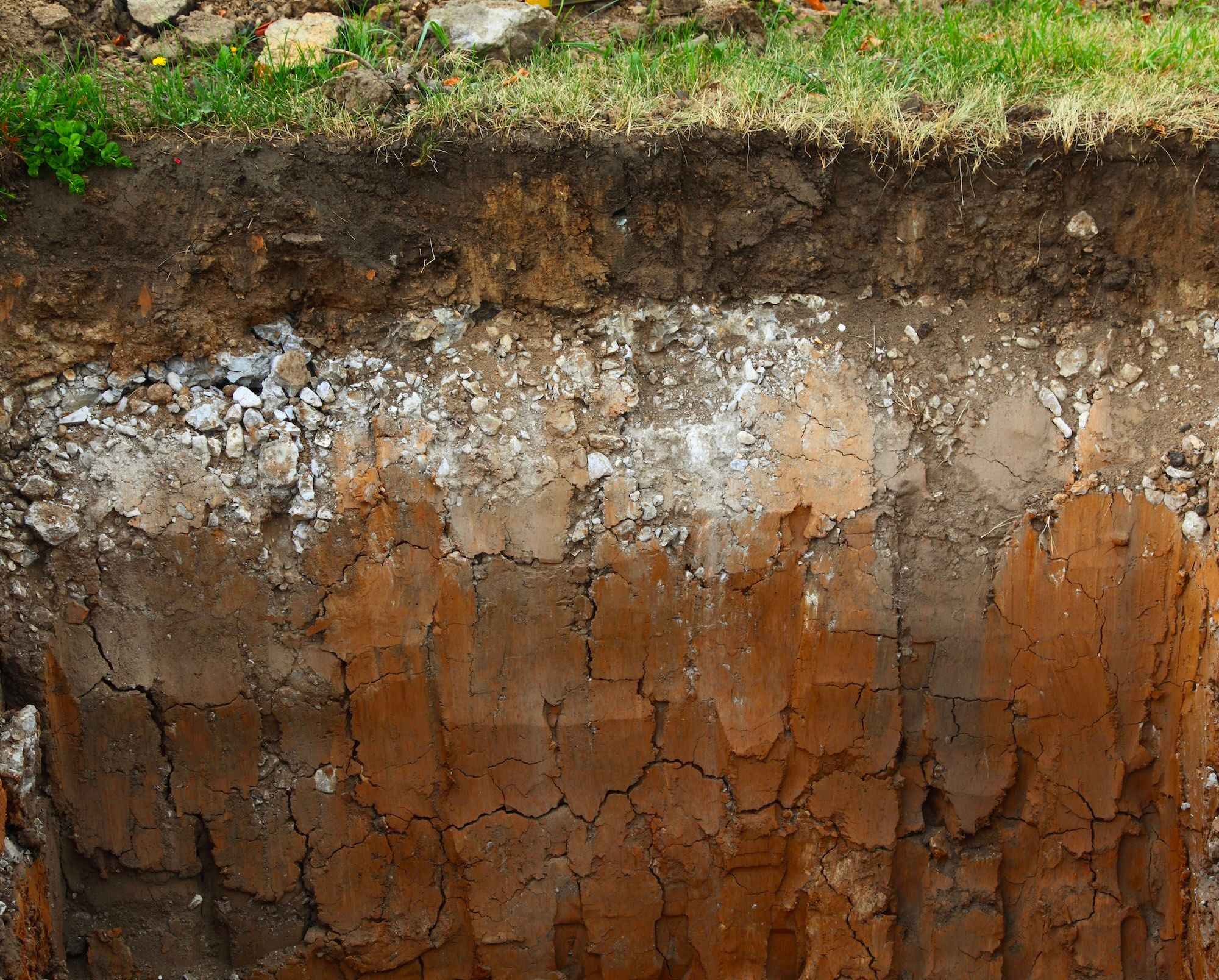 Soil composition
Soil plays an especially crucial role in carbon storage, acting as a significant reservoir for carbon dioxide and other greenhouse gases. Through processes like photosynthesis, plants absorb CO2 from the atmosphere and store carbon in the soil as organic matter. Thus, soil erosion poses a threat to soil organic carbon consumption, leading to a decline in carbon accumulation and negatively impacting terrestrial ecosystem carbon pools.
Sustainable soil management practices, including regenerative agriculture techniques like crop rotation and agroforestry, are essential for preserving soil health and mitigating the loss of soil organic carbon. Conservation agriculture and conservation tillage practices can also enhance soil organic carbon sequestration by minimising soil disturbance, incorporating crop residues, and promoting microbial activity. These practices not only improve soil structure and fertility but also contribute to mitigating climate change by capturing and storing atmospheric carbon.
Let’s make soil healthy again!
Carbon storage in soil can become a crucial step on our path to mitigating climate change by sequestering significant amounts of carbon dioxide (CO2) from the atmosphere. However, the degradation of soils is a critical global issue, with approximately 30% of the world's soils currently deemed as degraded, and a staggering 60-70% considered unhealthy according to a recent report by the European Commission. What follows, the stability of carbon stored in depositional settings, so critical for long-term carbon sequestration, is endangered. Conserving lands that already store so much greenhouse gases should become our top priority as it prevents the release of stored carbon and methane back into the atmosphere which could have reversed effects than anticipated. Thus, it is highly important to monitor and study the healthiness of soil through various indicators.
Conventional soil mapping relies on labor-intensive and expensive field surveys. Soil ground sampling involves driving a sampling tube into the soil, typically to a depth of 10cm, and extracting a soil core. Multiple samples from various locations within the area of interest are combined to obtain a representative sample. However, the precision of soil sampling can be compromised by factors such as incorrect depth and sample size, leading to inaccurate representations of soil nutrient or carbon content and strength. Ensuring accurate depth and sample sizes requires careful grid division of large sites and taking multiple samples from each section. Cross-contamination from unclean equipment and failure to consider the site's history or neglecting proper site restoration can further distort results. Therefore, special attention to sampling protocols and site conditions is essential to ensure reliable soil data for construction or agricultural projects.
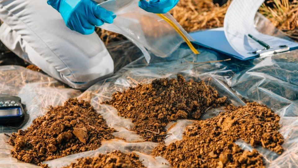 Physical soil sampling
Remote sensing can be the solution we are looking for
In contrast, remote sensing can become more time-efficient and cost-effective way of soil monitoring due to its ability to swiftly and accurately map various soil physiochemical properties. Soil organic carbon, salinity, and nitrogen are only some indicators that could be controlled at a high resolution using for example optical sensors.
Satellite and remote sensing models that Meteory offer are increasingly valuable in monitoring hydric stress, urbanisation levels, and air pollution, all of which can contribute to further soil degradation. Assessing hydric stress in agricultural regions helps farmers optimise irrigation practices and mitigate drought impact on soil. Urbanisation monitoring involves tracking land use changes and infrastructure development, which can lead to soil compaction, contamination, and loss of arable land. Meteory’s data also offer insights into air pollution by monitoring pollutant emissions of sulphur dioxide, methane or nitrogen dioxide which can become poisonous for the soil’s quality.
Using satellite and remote sensing technology for monitoring soil organic carbon levels and other critical soil properties provides advantages in terms of scale, frequency, and long-term monitoring capabilities, allowing for monthly or even more frequent assessments of soil health. This shift from sporadic ground sampling to regular satellite-based monitoring offers more accurate and real-time representation of the soil’s quality which can positively impact future decisions about local territories and sustainability. Furthermore, remote sensing aids in sustainable farming choices by monitoring crop growth stages, soil moisture levels, and mineral richness, thereby promoting soil conservation efforts and informing sustainable land management practices.
The lack of comprehensive soil information at global, national, and local levels can lead to uninformed policy decisions, continued land and water resource degradation, and in result increased carbon emissions. Remote sensing offers a solution by extending existing soil survey datasets, segmenting landscapes into homogeneous units, and facilitating digital soil mapping. While the application of remote sensing in soil surveys is still evolving, its potential to enhance soil and terrain mapping on a global scale is undeniable.

Aleksandra Jaworska • May 23, 2024